Kirim Kilat
A demo internal tool for the motorbike couriers and dispatchers of a regional delivery company in Pontianak and Jakarta: daily runs, parcel scanning, proof of delivery, COD reconciliation, and a live map.
What it does
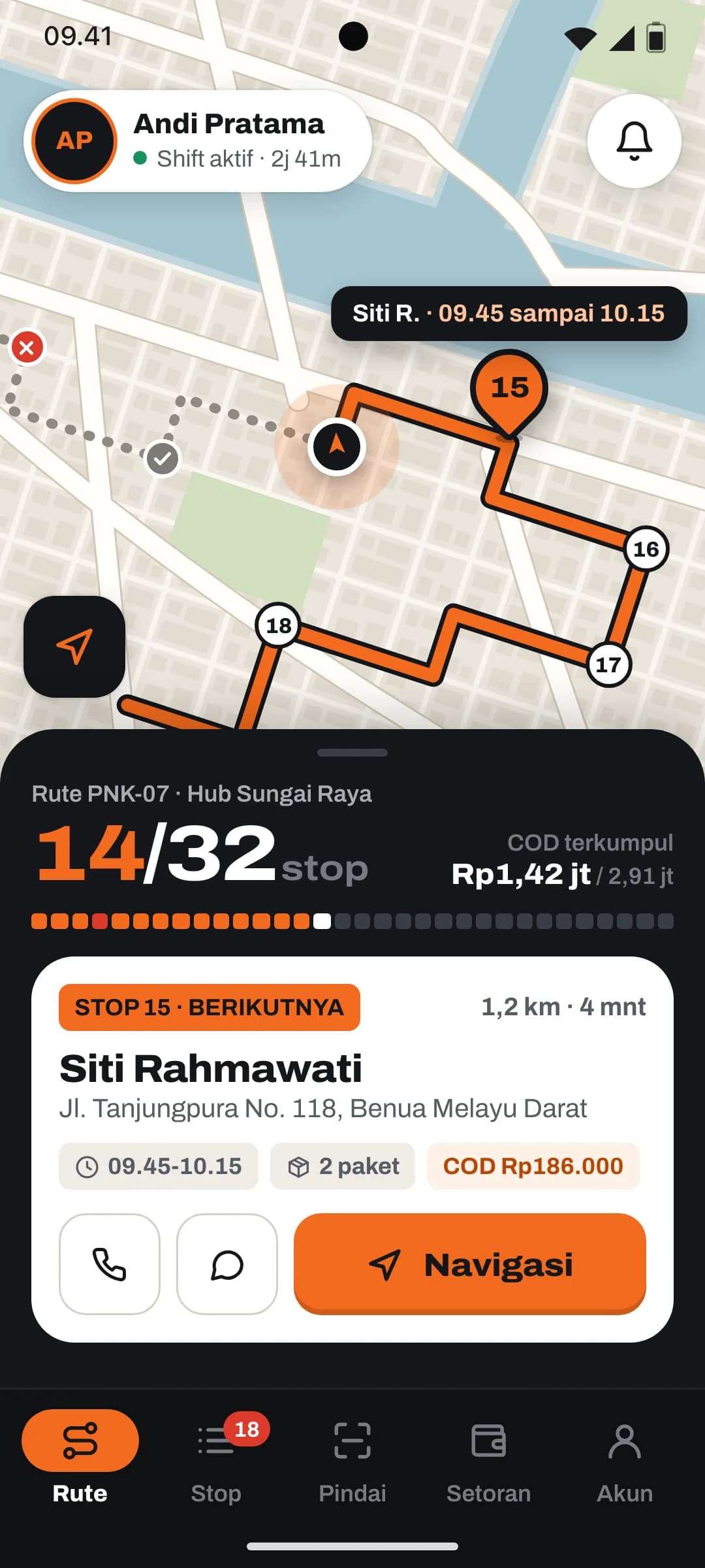
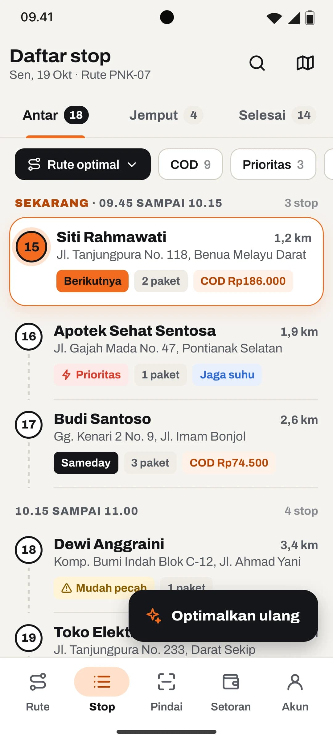
- Daily run with progress, stops remaining, and COD to collect
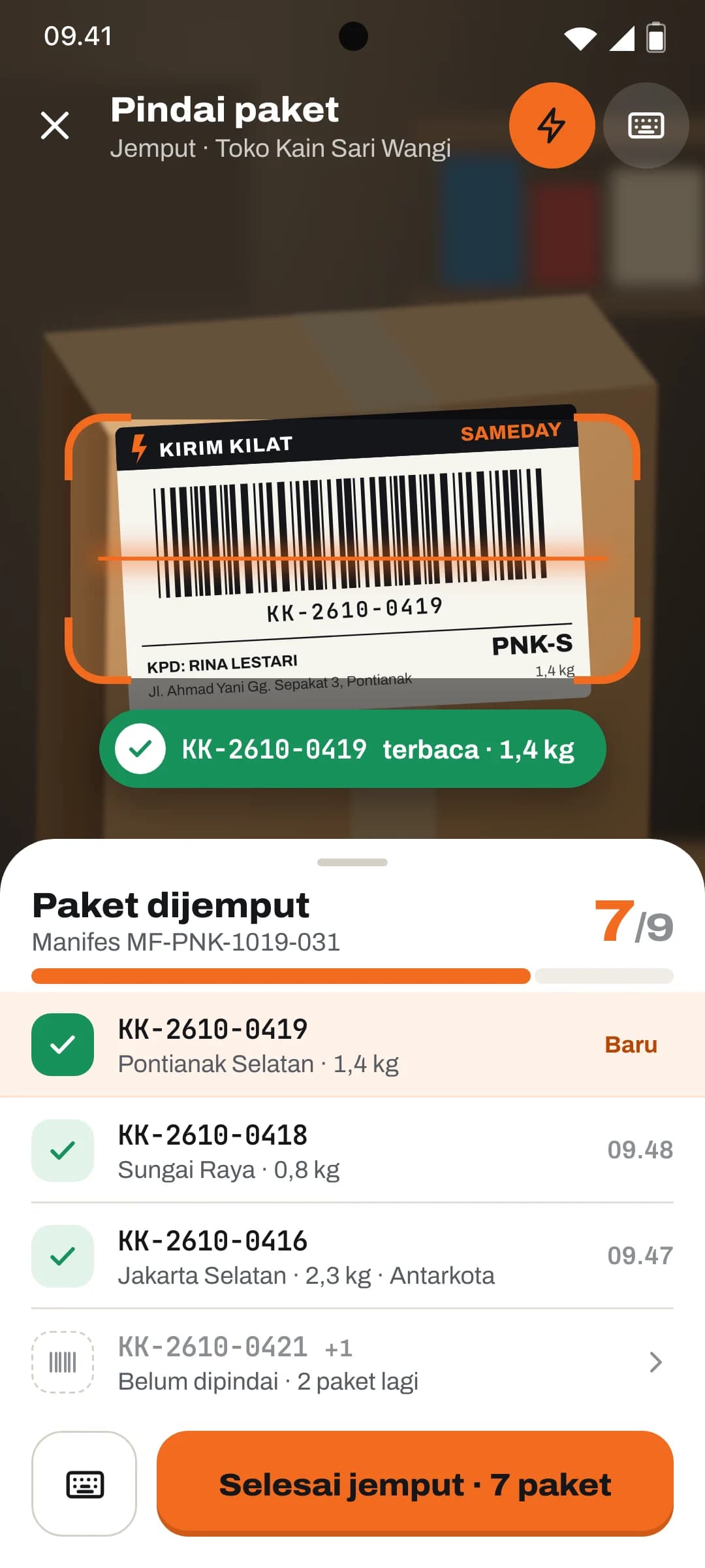
- Parcel scanning at pickup and handover with the phone camera
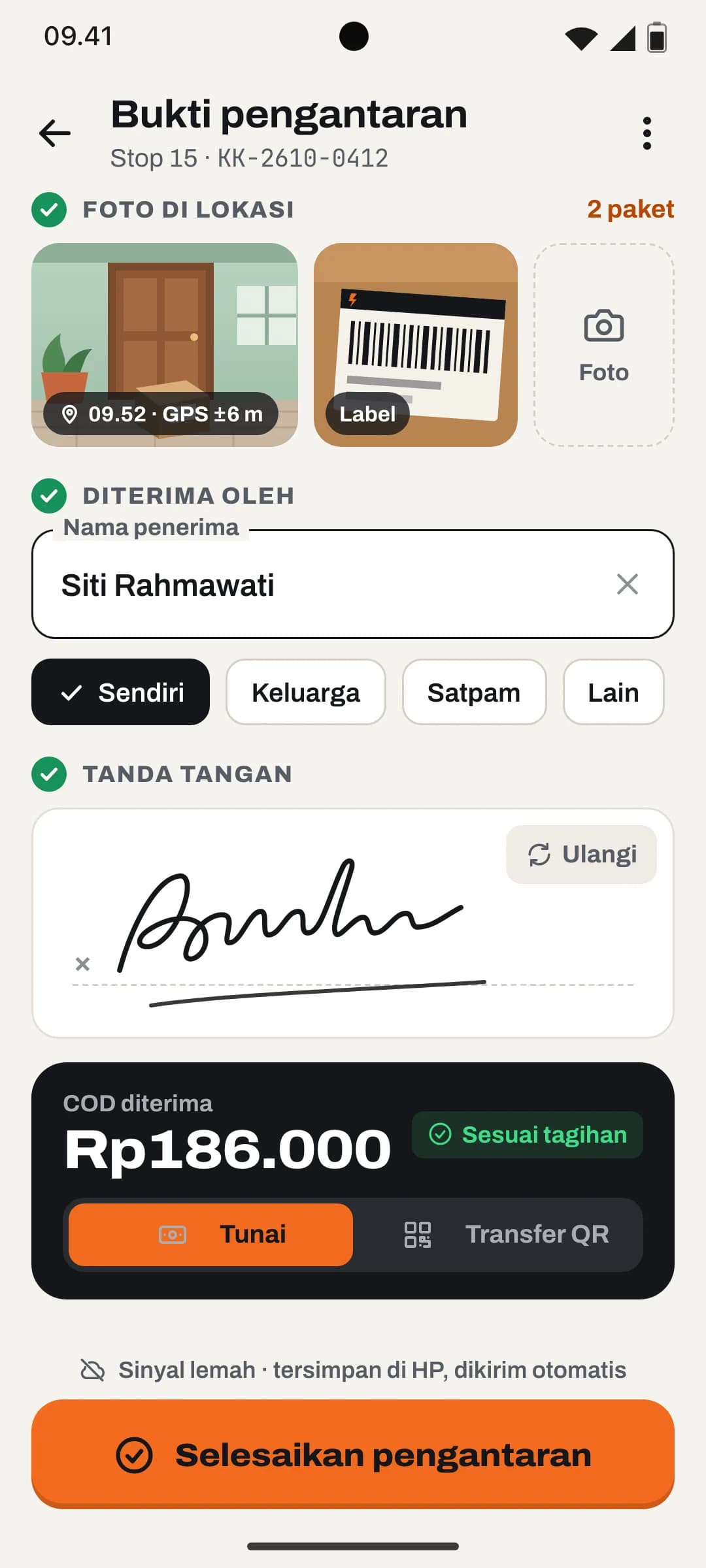
- Proof of delivery: GPS-stamped photo, recipient name, and signature
- Works offline and syncs automatically when signal returns
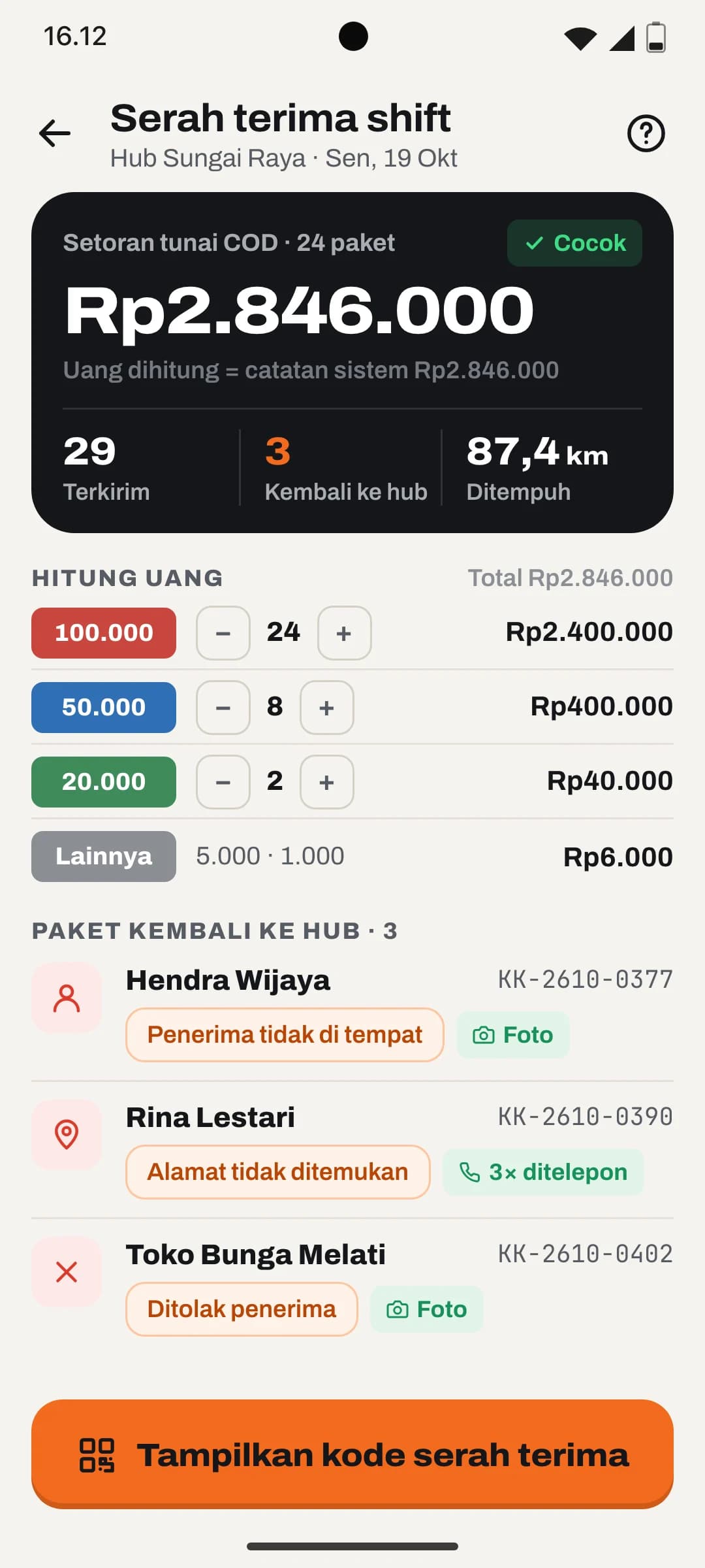
- End-of-shift handover with cash count and return reasons
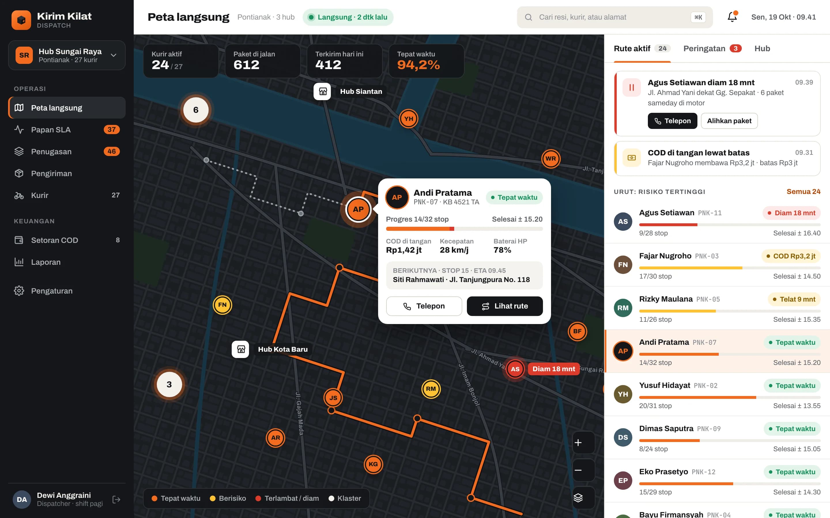
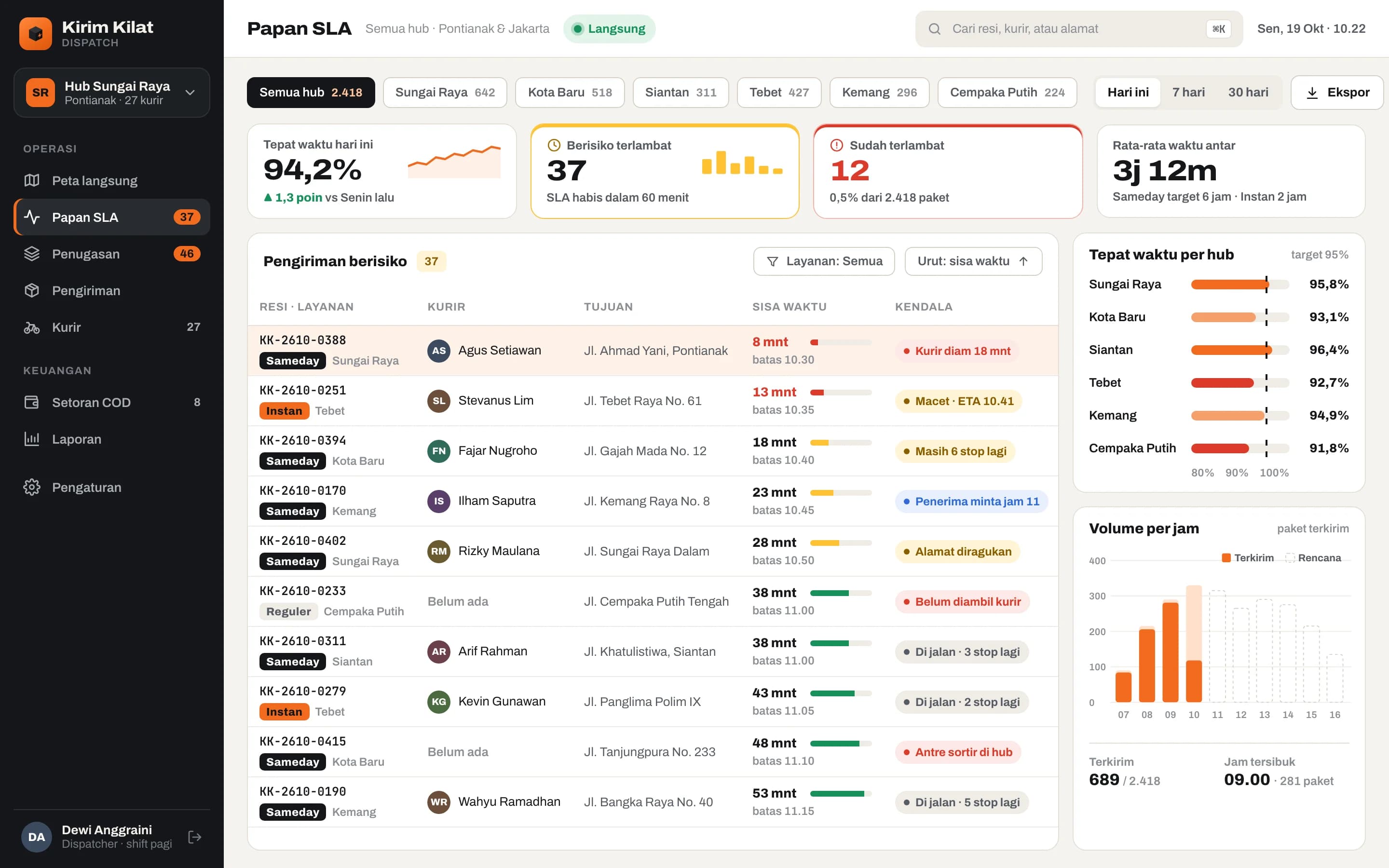
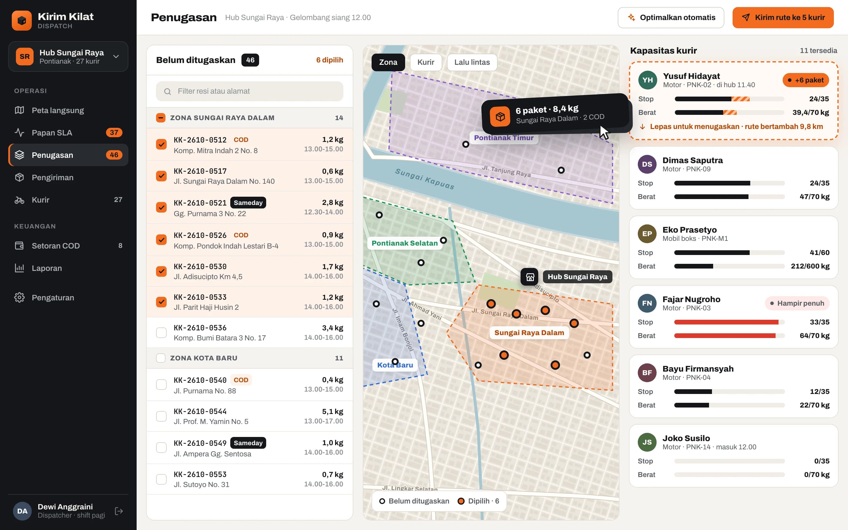
- Dispatcher dashboard: live map, SLA board, and drag-and-drop assignment
Kirim Kilat is a self-initiated demo by Wailo, not a client project. Picture a regional courier company with hubs in Pontianak and Jakarta that still dispatches through WhatsApp groups: address lists shared as photos, proofs of delivery scattered across couriers' phone galleries, COD cash reconciled by hand at the end of every shift, and dispatchers with no idea who is stuck on the road until a customer calls.
The courier app is designed to be used on a motorbike in full sun: safety orange on asphalt black, large numerals, 56 dp buttons, and one primary action per screen. Today's run, scanning parcels at pickup, recipient photo and signature, and counting cash at handover follow the order a courier actually works in. The dispatcher dashboard is denser: a live map with clusters, an SLA board with per-shipment countdowns, and drag-and-drop assignment that shows each courier's remaining capacity as you drop.
Technically, the Android app would be built in Kotlin with Jetpack Compose on a local database and a WorkManager queue, so proofs and payments are kept when signal drops and sync on their own later. The Next.js dashboard receives courier positions over WebSockets, PostgreSQL with PostGIS stores zones, routes, and location history, and the route optimisation service and map SDK sit behind interfaces that can be swapped.
What we would validate next with real couriers and dispatchers: whether proof of delivery is fast enough at a recipient's gate, which COD limits feel fair, and which alerts genuinely help a dispatcher rather than adding noise.
Build something like this
One message is enough to start. We reply with a clear scope, a cost range, and a timeline.